
English| EUR
Suggested for you
More currencies
Choose a language
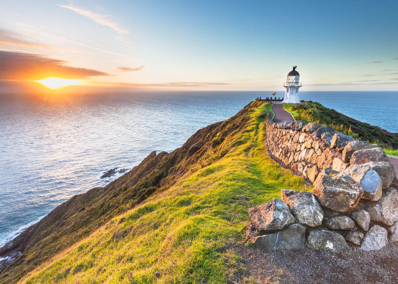
Cape Reinga looks close on a map of Northland — a lighthouse on the tip of the same landmass that holds the Bay of Islands. On the ground, the Aupōuri Peninsula turns that proximity into a full day behind the wheel, ending at Te Rerenga Wairua. This how far from Paihia to Cape Reinga guide gives the road distance, realistic drive times and the practical consequences of both.
Quick answer
Cape Reinga sits roughly 210 km north of Paihia by road, a drive of about three to three and a half hours each way via State Highway 10 and State Highway 1 through Kaitaia. Allow six to seven hours of driving in one day. Entry to the reserve is free, and the site opens daily 07:00–20:30.
Cape Reinga is not the northernmost point of the New Zealand mainland. That distinction belongs to the Surville Cliffs on North Cape, roughly thirty kilometres to the east and off limits to visitors. What the cape holds instead is meaning: in Māori tradition this is Te Rerenga Wairua, the leaping place of spirits, where the dead are said to depart along the roots of a weather-bent pōhutukawa below the lighthouse. Anyone working out how far from Paihia to Cape Reinga is, in practice, measuring the Aupōuri Peninsula — a narrow spine of dune, farmland and forest that must be crossed twice in the same day. The scale surprises people because the map flattens it. Northland's highways are two lanes, often winding, and the last section of sealed road to the cape was completed only in 2010. Distance here behaves less like kilometres and more like hours. The Far North rewards patience: cattle trucks, one-lane bridges and long unbroken stretches where overtaking rarely pays. Fuel and food options thin out beyond Kaitaia, mobile coverage becomes patchy across the Te Paki Recreation Reserve, and the reserve itself is managed by the Department of Conservation rather than a ticketed operator, so nothing at the end of the road opens later to accommodate a slow start. The address — Cape Reinga Road, Te Paki 0484 — marks a car park, a walkway and a lighthouse, not a town. That arithmetic shapes the decision. Some visitors commit to the full self-drive, leaving the Bay of Islands in darkness to reach the headland while the Tasman Sea and the Pacific Ocean are still colliding in flat morning light off the point. Others hand the driving to a guided Cape Reinga tour from Paihia, which folds in Ninety Mile Beach and the Te Paki sand dunes — stretches most rental agreements forbid drivers from attempting alone. Northland landmarks cluster along the same corridor, from Mangonui's waterfront to the kauri forests inland, which is why the return leg so often takes longer than the outbound one. Either way, the honest framing of how far from Paihia to Cape Reinga is not a number on a signpost but a full day committed, best begun early and planned around the lighthouse rather than around lunch.
“Distance here behaves less like kilometres and more like hours.”
Cape Reinga is located at the northern tip of the North Island, approximately 210 kilometers from Paihia. Reaching this remote destination requires navigating the main arterial routes of the Far North.
State Highway 11 to State Highway 1, then follow Cape Reinga Road
Coordinated tour departures from Paihia via State Highway 1
The final approach is via Cape Reinga Road, Te Paki 0484, which leads directly to the car park at the reserve.
To manage the travel time from Paihia effectively, prioritize an early start to align with the recommended arrival window of 07:00–10:00. Arriving during this period ensures easier parking and avoids the peak midday crowds that arrive later in the day.
Warm, 20°C–25°C. Popular period for domestic travelers.
Expect busy car parks and higher visitor numbers during these months.
Cooler, 10°C–16°C. Frequent rainfall is common.
This period offers quieter paths and cooler temperatures, ideal for those avoiding heat.
Mild, 14°C–20°C. Stable weather patterns.
These months provide a balance of pleasant temperatures and manageable visitor levels.
—
Visiting on weekdays during the 07:00–10:00 arrival window provides the most consistent access to parking and facilities.
Verdict: The best time to visit is during the shoulder months of April or October, specifically arriving between 07:00 and 10:00 on a weekday.
Cape Reinga is open daily to visitors throughout the week, including weekends and public holidays. Please review the operating schedule below to plan your visit accordingly.
Cape Reinga/Te Rerenga Wairua is a public conservation area managed by the Department of Conservation. Access to the reserve and the lighthouse walkway does not require an entrance fee.
Verdict: A typical adult pays 0 NZD for entry, as there are no admission or parking fees required to visit the Cape.
This plan suits self-drivers and coach passengers making the return trip from Paihia in a single day, running roughly 11 to 12 hours door to door. It assumes an early start so the Cape is reached inside the recommended 07:00–10:00 arrival window.
Leave town at first light and head north via State Highway 10. Fuel up before you go, as service stations north of Kaitaia are sparse.
Break for 30 minutes in the last sizeable town on the route. This is the final reliable spot for cash, groceries and a proper restroom.
Arrive at Cape Reinga Road, Te Paki, and take the sealed 20-minute downhill path to the lighthouse and signpost. Allow an hour to watch the Tasman Sea and Pacific Ocean meet at Te Rerenga Wairua.
Drive the short gravel side road down to Tapotupotu Bay for a quieter beach and a picnic. Budget 45 minutes including the slow descent.
Stop at the Te Paki Stream car park for the giant dunes. The climb takes 15 minutes and sandboarding adds another hour.
Pause at an access point or the Ancient Kauri Kingdom in Awanui on the way south. Only 4WD tour vehicles should drive the beach itself.
Retrace the route south, arriving back in the late afternoon. Watch for stock and logging trucks on the narrow sections near Mangonui.
Cape Reinga sits at the end of a long, remote stretch of Northland with few services, so a little preparation before leaving Paihia makes the day far easier.
Everything you need to know about how far from paihia to cape reinga
When considering how far from paihia to cape reinga, it is important to note that the drive spans approximately 200 to 220 kilometers one way. This journey takes you through diverse Northland landscapes and typically requires three to four hours of driving time in each direction.
Travelers often ask about the total distance from Paihia to Cape Reinga to understand the scale of a day trip. You should anticipate a long day of travel covering significant terrain across the Far North district.
Because knowing how far from paihia to cape reinga is just one part of the journey, remember that total tour durations often span ten to twelve hours. This accounts for the extensive driving time required to navigate the coastal roads safely.
There is no cost to access the site, as the entrance fee is 0 NZD. Visitors can explore the grounds and the iconic lighthouse location for free during standard opening hours.
The location follows consistent operating hours and is open daily from 07:00–20:30, including weekends and public holidays. Please plan your return trip to ensure you depart the area before the gates close.
To avoid peak midday crowds and find easier parking, the best arrival window is 07:00–10:00. Arriving early provides a quieter experience at the scenic headland where the Tasman Sea meets the Pacific Ocean.
The site features essential facilities including restrooms and marked trails leading to the lighthouse. Visitors exploring how far from paihia to cape reinga will find a well-maintained environment managed by the Department of Conservation.
Planning a successful excursion involves coordinating transport and timing to accommodate the long distance. Dedicated tours are a popular option for those who prefer to leave the navigation to professional drivers.